Sharing Economy's Dirty Secret: More Sharing, More Waste

Sharing Economy's Dirty Secret: More Sharing, More Waste

Scientists Want to Bring Back the Ice Age to Save Us

Whale Pump: How Whale Dung Fertilizes the Ocean

Climate Tipping Cascades: How One Threshold Topples All

Iron-Air Batteries Could Solve Renewable Energy Storage
Megadrought Is Redrawing the Map of Earth's Ecosystems
TL;DR: Climate scientists analyzing 200 years of data reveal that while total annual rainfall in many regions remains stable, the way rain falls has fundamentally changed: fewer rainy days, more intense downpours, and shifted seasonal patterns. Driven by atmospheric warming that increases moisture-holding capacity by 7% per degree Celsius, these shifts are overwhelming infrastructure, disrupting agriculture, and creating simultaneous flood-drought risks across 33.6% of global land area. From tripled hourly extreme rainfall in the U.S. to consecutive droughts in Madagascar, the evidence demands urgent adaptation through upgraded infrastructure, flexible agriculture, nature-based solutions, and climate-informed planning to protect billions whose water security depends on predictable precipitation.
By 2030, the rainfall you experience in your hometown will likely look nothing like the precipitation your great-grandparents knew. Climate scientists analyzing data spanning two centuries have uncovered a troubling pattern: while total annual rainfall in many regions remains relatively stable, the way rain falls - its intensity, frequency, and seasonal distribution - has fundamentally transformed. This shift, driven by atmospheric warming, is rewriting the rules of agriculture, water security, and extreme weather risk across every continent.
Recent advances in climate reconstruction have allowed researchers to piece together a remarkably detailed picture of how precipitation has evolved since the early 1800s. By combining proxy data from tree rings, sediment cores, and ice sheets with modern satellite and gauge observations, scientists have identified unmistakable trends that challenge our basic assumptions about rainfall.
The most striking finding? We're not necessarily getting more or less rain overall - we're getting it differently. A landmark study from Hebrew University and Tel Aviv University found that while Israel's total annual precipitation has remained roughly constant since 1975, the number of rainy days has declined by about 2% per decade, while the intensity of each rain event has increased by the same margin. During transitional seasons, this trend doubles: rainy days have decreased by approximately 5% per decade.
This pattern isn't unique to the Mediterranean. Analysis of nearly 60 years of data from AccuWeather's comprehensive weather records shows that across the contiguous United States, days with one inch or more of rain have increased by approximately 9% since 1965. More dramatically, daily events delivering four inches of rain have surged by 70% over the same period. Perhaps most alarming, hours per year experiencing one inch or more of rainfall have nearly tripled since 1985.
A University of Edinburgh study examining the catastrophic August 2020 Carmont, Scotland derailment - triggered by intense rainfall that washed out track ballast - quantified this risk with chilling precision: intense deluges like the one that caused the accident are now 15-20% more likely than they were in the 1990s, and could become 30-40% more probable if global warming exceeds two degrees Celsius above pre-industrial levels.
To understand how today's rainfall compares to centuries past, scientists have become environmental detectives, extracting climate clues from nature's own record-keeping systems. These "proxy" data sources offer windows into precipitation patterns long before the first rain gauge was installed.
Tree rings provide an annual chronicle of local growing conditions, with wider rings typically indicating wetter years and narrower rings suggesting drought. Researchers analyzing ancient trees can reconstruct precipitation variability with year-by-year resolution extending back centuries, and in some cases, millennia. The reliability of tree-ring data has improved dramatically as scientists have learned to account for non-climatic factors like insect damage, fire scars, and competition for sunlight.
Lake and ocean sediment cores offer lower temporal resolution - typically capturing changes across decades to millennia - but provide complementary evidence of major hydrological shifts. Layers rich in certain pollen types, organic matter, or mineral deposits reveal periods of abundant rainfall or prolonged drought. When we see evidence of past abrupt climate shifts in these records, such as those documented in ice cores from the last glacial period, it underscores the potential for rapid and significant environmental change.
Ice cores from Greenland and Antarctica preserve atmospheric gases, dust particles, and chemical signatures that reveal global climate conditions extending back 800,000 years. The ratio of oxygen isotopes trapped in ice provides particularly valuable information about historical precipitation and temperature.
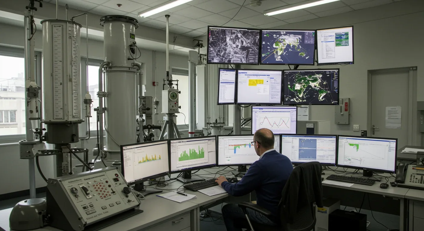
The transition from these proxy methods to direct measurement began in earnest during the 19th century with early rain gauge networks, expanded dramatically in the mid-20th century with weather radar systems, and achieved truly global coverage only in recent decades with satellite monitoring. The Global Precipitation Climatology Project (GPCP), combining satellite and gauge data since 1979, and the more recent Global Precipitation Measurement (GPM) mission launched in 2014, now provide unprecedented accuracy in tracking precipitation worldwide.
This layered approach - combining proxy reconstructions with modern observational networks - allows scientists to contextualize today's changes within the framework of natural climate variability spanning centuries and millennia.

The fundamental driver behind shifting rainfall patterns is deceptively simple physics: warmer air holds more moisture. For every degree Celsius of warming, the atmosphere's water-holding capacity increases by approximately 7%, following the Clausius-Clapeyron relationship. This thermodynamic reality is intensifying Earth's hydrological cycle, creating more extreme precipitation events even in regions where total annual rainfall changes little.
But the story is more complex than simple atmospheric moisture content. Climate change is also altering large-scale atmospheric circulation patterns that govern where and when precipitation falls. The expansion of the Hadley cell - the massive tropical circulation system that drives subtropical deserts - is pushing dry zones poleward. This shift is reducing rainfall during transitional seasons in regions like the Eastern Mediterranean, as the dry subtropical descending branch encroaches northward in early spring and late autumn.
Climate models consistently project that these patterns will intensify. The IPCC's 2021 Physical Science Basis report concluded that in high latitudes, precipitation is likely to increase, while it is projected to decrease over large parts of the subtropics. Changes to monsoon precipitation are expected across Asia, Africa, and the Americas, though the specific impacts will vary significantly by region.
High-resolution climate modeling has revealed another critical dimension: extreme precipitation sensitivity depends heavily on both spatial resolution and how quickly models calculate atmospheric processes. Research using the OpenIFS atmospheric model showed that both simulations and reanalysis products underestimate the rates of extreme precipitation compared to observations, with biases largest at lower resolution (100 km) and decreasing substantially at higher resolution (25 km). The study found that large-scale precipitation increases with finer spatial resolution and shorter computational time steps, while convective precipitation shows more complex sensitivity.
This means our estimates of future rainfall extremes may still be conservative - the real world could deliver even more intense events than current models predict.
The transformation of global rainfall patterns is creating a patchwork of regional winners and losers, with profound implications for agriculture, water infrastructure, and human settlement patterns.
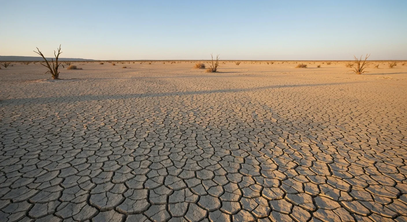
Spatial and temporal concentration of rainfall has increased across vast swaths of the planet. A comprehensive analysis using the ERA5-Land dataset (1951-2020) found that 46.4% of global land area shows increasing spatial concentration of precipitation - meaning rain is falling in fewer locations - while 67.4% shows increasing temporal concentration - rain is falling on fewer days. Most alarmingly, 33.6% of global land area exhibits both patterns simultaneously, creating a double-edged threat of more severe flooding alternating with more intense drought.
North Eastern Africa exhibited the most pronounced spatial concentration trend, with the spatial Gini coefficient increasing by 1.4×10⁻³ per year (p < 0.001). Regions experiencing simultaneous spatial and temporal concentration include East, Southeast, and South Asia; West and North America; parts of South America; Europe; and multiple African regions. In these zones, traditional water management strategies calibrated to historical precipitation patterns are rapidly becoming obsolete.
Southern Madagascar provides a stark example of intensifying drought cycles. Analysis of drought characteristics from 1981-2022 revealed that drought events have become more consecutive during the most recent period (2017-2022), with intensity exceeding SPI-3 values of -1.8. The region is currently facing severe food insecurity due to a significant drop in rice, maize, and cassava yields caused by what researchers describe as the most severe drought in four decades, compounded by sandstorms and pest invasions.
The United States is experiencing the flood side of this equation. The AccuWeather analysis documented not just increasing frequency but accelerating intensity of extreme rainfall. The 70% increase in 4-inch daily rain events since 1965, combined with the near-tripling of hours with 1-inch rainfall since 1985, is overwhelming stormwater infrastructure designed for climate conditions that no longer exist. Dr. Joel N. Myers, AccuWeather's founder, emphasized the cross-sectoral impact: "By analyzing nearly 60 years of weather records, we can clearly show how our climate is changing and the impact it has on industries, such as infrastructure, insurance and agriculture."
European precipitation responses to climate and land-use change show remarkable spatial heterogeneity. A detailed assessment comparing precipitation across 19 European sub-regions found that land-use change can induce opposing responses in neighboring areas. Summer precipitation in Southern France increased by 0.8 mm in scenarios incorporating land-use change, while Alpine regions showed declines. These local variations underscore the necessity of region-specific adaptation planning rather than one-size-fits-all approaches.
Monsoon systems, which provide the majority of annual rainfall for billions of people across Asia, Africa, and the Americas, are showing signs of disruption. While the IPCC projects changes to monsoon precipitation that will vary by region, the general pattern involves shifts in timing, intensity, and spatial extent that threaten agricultural systems calibrated over millennia to specific rainfall regimes.
The transformation of rainfall patterns is exposing vulnerabilities across interconnected systems in ways that were difficult to anticipate when infrastructure and settlement patterns were established.
Infrastructure obsolescence is perhaps the most immediate challenge. Municipal stormwater systems in South Africa - and indeed worldwide - were designed for lower population densities and less intense weather events. As the Institute for Municipal Engineering of Southern Africa (IMESA) noted following devastating Western Cape floods, many closed piped networks, curb inlets, and grid structures are now under immense strain. Cities including Johannesburg, Durban, and Tshwane have all experienced recurring flood events, some with tragic outcomes.
The problem extends beyond design capacity. Human interference with stormwater systems - including intentional removal of manhole covers followed by dumping of builder's rubble, household waste, clothing, tires, and even large rocks - creates blockages that exacerbate flood risk. This "stormwater system abuse" highlights how climate pressures interact with social factors to compound vulnerability.
Traditional design standards are rapidly becoming inadequate. In 2023, IMESA and the Water Research Commission released a Best Practice Guideline for Design Flood Estimation in Municipal Areas, recommending that planning account for multiple return periods beyond the traditional 100-year flood standard. The guideline recognizes that extreme rainfall probability is projected to rise by 15-20% under current warming trajectories and 30-40% if warming exceeds 2°C - meaning a "100-year flood" may now occur every 50-60 years, or even more frequently.
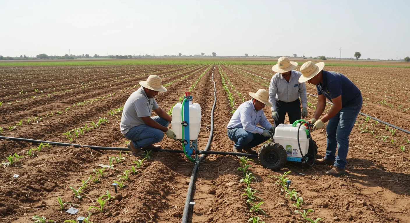
Agricultural disruption from changing rainfall patterns operates through multiple mechanisms. Reduced number of rainy days, even with stable total precipitation, means longer dry periods that stress crops and increase irrigation demands. Conversely, more intense individual rain events increase erosion, nutrient runoff, and soil compaction while potentially overwhelming irrigation infrastructure designed for gentler precipitation. The timing of seasonal rainfall - critical for planting and harvesting decisions made generations in advance - is becoming less predictable.
Data scarcity in vulnerable regions hampers adaptation efforts. A study evaluating drought trends in the West Bank demonstrated that while bias-corrected ERA5 reanalysis data can effectively replace sparse gauge networks for drought analysis, the raw satellite data requires substantial correction. Before bias correction, mean bias error for monthly precipitation reached -27.66 mm at some stations; after correction using observed data, errors dropped to near zero. However, many at-risk regions lack even the baseline gauge observations needed to perform such corrections, creating a cruel irony: the places most vulnerable to changing rainfall patterns often have the least reliable data to guide adaptation.
Ecosystem disruption follows rainfall regime changes with cascading effects. Analysis of drought impacts on vegetation in southern Madagascar using NDVI (Normalized Difference Vegetation Index) from 2000-2022 showed strong correlations between precipitation deficits and vegetation decline across multiple timescales (SPI-3, SPI-6, and SPI-12). These vegetation changes alter wildlife habitat, carbon sequestration, erosion patterns, and fire risk - effects that can persist long after precipitation patterns stabilize.
Different regions are responding to rainfall transformation with varied strategies reflecting their economic capacity, institutional frameworks, and cultural contexts.
High-income nations are investing heavily in infrastructure upgrades and advanced monitoring. The development of sophisticated bias-correction techniques for satellite rainfall products exemplifies this approach. Research on TRMM (Tropical Rainfall Measuring Mission) and GPM data showed that linear scaling bias correction can improve the Pearson correlation coefficient with ground observations from 0.74 to 0.93 while reducing root-mean-square error from 68.4 mm to 23.3 mm and eliminating systematic bias. Such techniques enable reliable precipitation estimates even in areas with sparse gauge networks, informing water resource management and flood forecasting.
China's satellite infrastructure development demonstrates a state-led approach to improving precipitation monitoring. The FY-3G satellite constellation, launched as part of China's meteorological satellite program, includes the MWRI-RM (MicroWave Radiation Imager - Risk Mitigation) instrument with dual oxygen absorption sounding channels around 50 and 118 GHz. Research showed that incorporating these channels into deep learning models for 3D precipitation reconstruction substantially improves accuracy, particularly over land (RMSE reduction: 5.43% ± 1.56%) and coastal regions (5.47% ± 1.17%). This technology enables better monitoring of rapidly changing precipitation patterns across China's diverse climate zones.
Water-scarce regions are pioneering integrated drought-flood management frameworks. The concept of joint spatial-temporal concentration metrics - tracking regions where both the spatial distribution and temporal clustering of rainfall are increasing - provides a leading indicator for areas requiring simultaneous flood and drought mitigation infrastructure. This represents a fundamental shift from traditional approaches that treated floods and droughts as separate challenges.
The mining sector, facing rapid-onset floods that threaten personnel safety and infrastructure, has developed instructive adaptation protocols. Industry leaders now recommend that operations conduct climate-vulnerability audits and develop climate-change resilience strategies that include reviewing emergency preparedness plans, upgrading capacity beyond historical design standards, and implementing nature-based solutions like vegetated swales and geomorphic channels to dissipate runoff energy. Pre-erection and modular construction designs reduce on-site construction time, narrowing windows of exposure to extreme weather events.
European modeling efforts are incorporating land-use change alongside climate change to improve regional precipitation projections. The LUCAS (Land Use/Cover Area frame Survey) dataset, integrated with high-resolution WRF (Weather Research and Forecasting) models, enables assessment of how land-use transformations interact with atmospheric warming to alter rainfall. This approach recognizes that human modification of land cover - through urbanization, deforestation, and agricultural intensification - can amplify or dampen climate-driven precipitation changes.
Weather regime analysis provides another lens for understanding and projecting precipitation changes. Research using the Community Earth System Model found that frequency changes of weather regimes are generally of secondary importance for explaining climate change signals in precipitation across the North Atlantic-European sector. Instead, regime-specific intensity changes - largely thermodynamic in nature - dominate. The γ parameter quantifying the relative contribution of frequency versus intensity changes typically remained below 0.25, meaning intensity shifts explain 75% or more of projected precipitation changes. This finding suggests that adaptation strategies should focus on managing more intense precipitation during existing weather patterns rather than preparing for entirely new circulation regimes.
As rainfall patterns continue evolving, individuals, communities, and institutions must develop new competencies and modify long-established practices.
Data literacy is becoming essential. Understanding the difference between raw and bias-corrected satellite precipitation products, interpreting standardized precipitation indices at multiple timescales (SPI-1, SPI-6, SPI-12), and recognizing the limitations of different data sources enables better-informed decisions about water management, agricultural planning, and infrastructure investment.
Flexible agricultural practices that can accommodate both intensifying dry periods and more concentrated rainfall events will prove crucial. This includes diversifying crop varieties to include drought-resistant and flood-tolerant species, implementing soil conservation techniques that reduce erosion during intense rain while retaining moisture during dry spells, and developing irrigation systems that can handle both supplemental watering during extended dry periods and excess water removal during deluges.
Infrastructure planning must embrace uncertainty. The traditional approach of designing for historical return periods no longer provides adequate protection. The Best Practice Guideline from IMESA recommends designing for multiple return periods and incorporating Water Sensitive Urban Design principles that work with natural hydrological processes rather than simply channeling water away. Regular maintenance of existing systems is equally critical - a stormwater network designed with adequate capacity will still fail if blocked by debris or compromised by neglect.
Early warning systems integrating real-time precipitation data with vulnerability mapping can save lives and reduce economic losses. The development of composite spatial-temporal precipitation concentration indices demonstrates how sophisticated metrics can identify high-risk areas before disasters strike, enabling proactive resource positioning and evacuation planning.
Nature-based solutions offer cost-effective complements to engineered infrastructure. Vegetated swales, rain gardens, permeable pavements, wetland restoration, and strategic reforestation can absorb excess rainfall, reduce runoff velocity, filter pollutants, and recharge groundwater - often at a fraction of the cost of expanding piped drainage networks.
Climate-informed finance and insurance mechanisms will need to evolve. As AccuWeather's analysis of flooding trends demonstrates, historical loss data no longer reliably predicts future risk. Actuarial models, bond ratings, and investment decisions must incorporate forward-looking climate projections rather than relying solely on past experience.
The transformation of global rainfall patterns represents one of climate change's most direct and immediate impacts on human welfare. From the subtle shift toward fewer but more intense rain events in Israel to the devastating consecutive droughts in Madagascar, from overwhelmed stormwater systems in South African cities to the triple increase in hourly extreme rainfall across America, the evidence is unambiguous: the precipitation regime that shaped human civilization is fundamentally changing.
Yet this challenge also presents an opportunity to build more resilient, adaptive systems better aligned with hydrological reality. By combining cutting-edge satellite technology with centuries-old proxy records, sophisticated climate models with local traditional knowledge, and engineered infrastructure with nature-based solutions, humanity can navigate this transition. The question is not whether rainfall patterns will continue to shift - they will - but whether our institutions, infrastructure, and mindsets will adapt quickly enough to protect the billions of people whose water security, food production, and physical safety depend on precipitation they can predict and manage.
The next decade will reveal whether we rise to this challenge or remain tethered to assumptions about rainfall that two centuries of data have conclusively overturned.

Saturn's moon Titan may harbour liquid water beneath its frozen crust, kept from freezing by ammonia acting as a natural antifreeze. New Cassini data suggests the interior could be slush with warm water pockets rather than a global ocean, and NASA's Dragonfly mission launching in 2028 aims to investigate whether this exotic environment could support life.

The cerebellum, long dismissed as merely a motor coordinator, forms dense circuits with the prefrontal cortex that shape cognition and emotion. Disruption of these pathways is now linked to schizophrenia, autism, and ADHD, opening new frontiers in diagnosis and non-invasive brain stimulation therapies.
Research shows the sharing economy often increases total resource consumption through the Jevons paradox and rebound effects. Ride-sharing adds billions of vehicle miles, co-working spaces use more energy per worker, and diffused responsibility erodes conservation behavior. Breaking the paradox requires congestion pricing, accountability design, and matching sharing models to appropriate resource types.

Illusory superiority causes most people to rate themselves above average in driving, intelligence, and ethics. This bias is rooted in metacognitive blind spots, shaped by culture, and carries real costs in healthcare, finance, and leadership. Structured feedback and institutional safeguards can help, but require ongoing effort.

Eastern skunk cabbage generates its own body heat through the alternative oxidase pathway, maintaining temperatures up to 35°C above freezing air and melting surrounding snow. This thermogenic ability, shared by roughly 90 plant species worldwide, reveals a level of metabolic sophistication that challenges assumptions about plant passivity.

America has 28 vacant homes for every homeless person, yet homelessness hit record highs in 2024. Speculative investment, geographic mismatches, and political barriers explain the paradox, while Finland and Vienna show that Housing First and social housing models can work when the political will exists.

Wafer-on-wafer bonding fuses logic and memory silicon at the atomic level, delivering up to 100x interconnect density over traditional packaging. TSMC, Intel, and Samsung are racing to commercialize the technology as AI chips hit the memory bandwidth wall.

Loading featured articles...